
Satellite images reveal Israel building 23-km barrier across Gaza
This digest was compiled by AI from multiple sources — links to the originals are below.
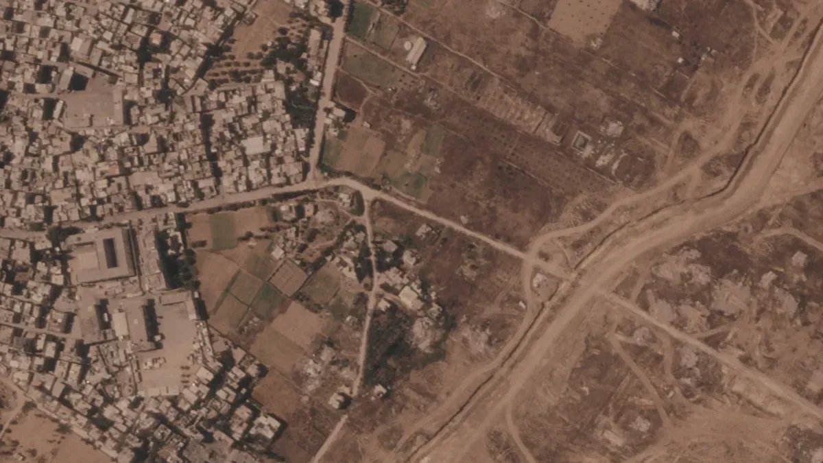
Satellite images published by the Associated Press reveal Israel is constructing a 23-kilometer earthen barrier across the Gaza Strip. The barrier, which runs along the temporary ceasefire line, is transforming it into a de facto border. Destroyed Palestinian towns are being replaced by military bases and new security lines.
The Barrier Construction
Satellite imagery analyzed by the Associated Press shows an earthen berm stretching over 23 kilometers across the Gaza Strip, from east to west. The structure runs along the temporary ceasefire line, effectively turning it into a permanent border. Construction began in recent weeks and has progressed rapidly, with heavy earthmoving equipment visible at multiple sites.
Military Infrastructure
The imagery indicates that destroyed Palestinian towns along the route are being cleared and replaced by military installations. New security roads and fortified positions are being built. The project resembles the Berlin Wall in its scale and intent, according to analysts cited by Sabah.
1 source
Time · lag behind first